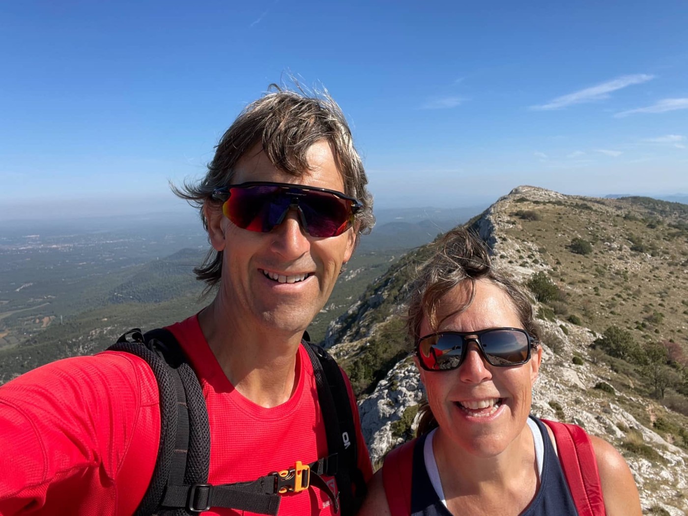
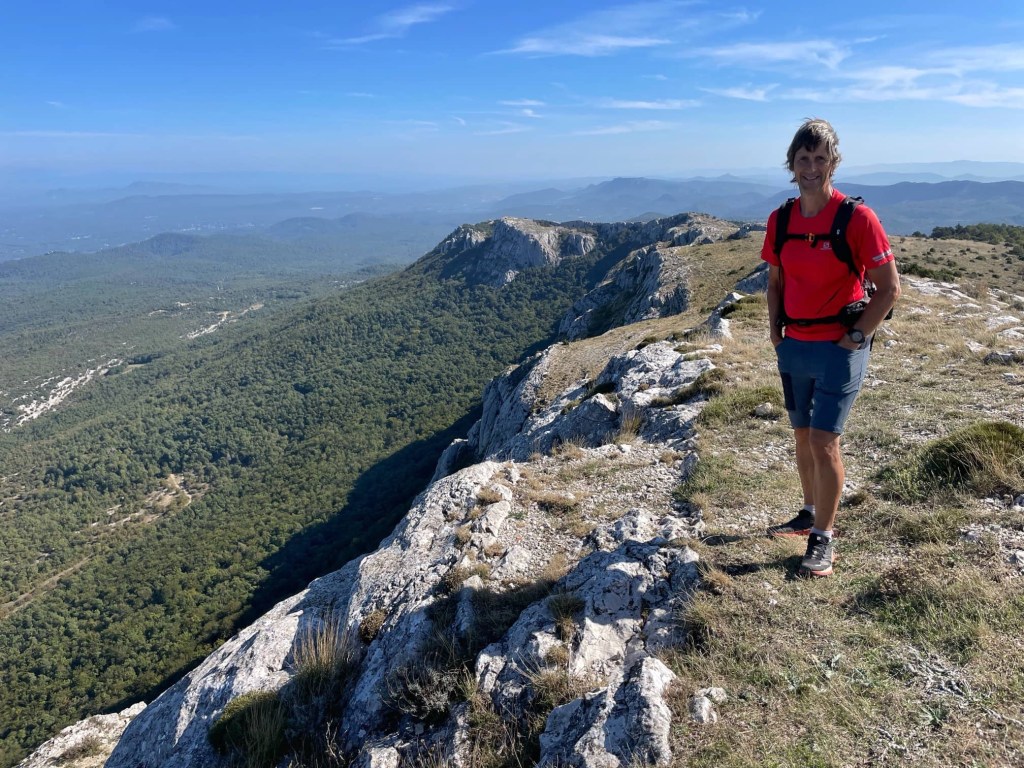
We’ve had another lovely 17 kilometre hike today, with much of it along a craggy limestone ridge that is 1148 metres at its highest points, Signal Les Béguines and Jouc de l’Aigle. The views were wonderful, but the walk wasn’t without issues 😜
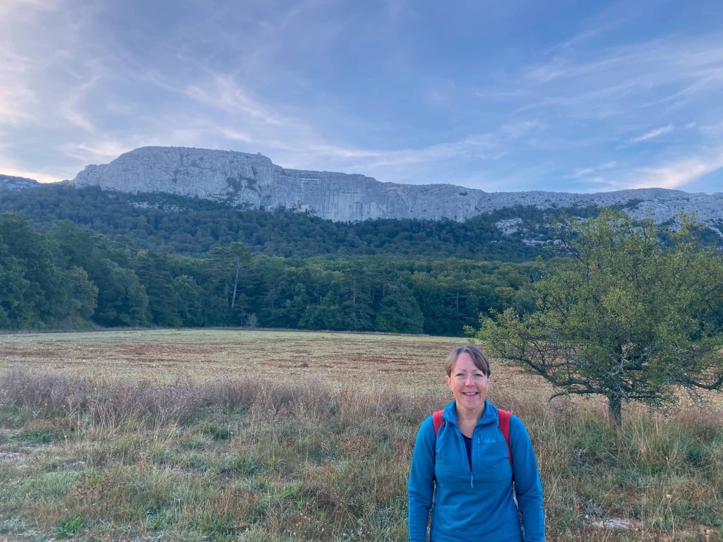

We set off quite early before the sun peaked over the ridge, and the first 6 kilometres of the walk were through forest along the bottom of the craggy mountainside. On the side of the cliff, we could see the shrine and grotto of Ste-Marie Madeleine, a place of pilgrimage since the 5th century. It is said that Mary Magdalene took refuge here and lived as a hermit for the last 30 years of her life.

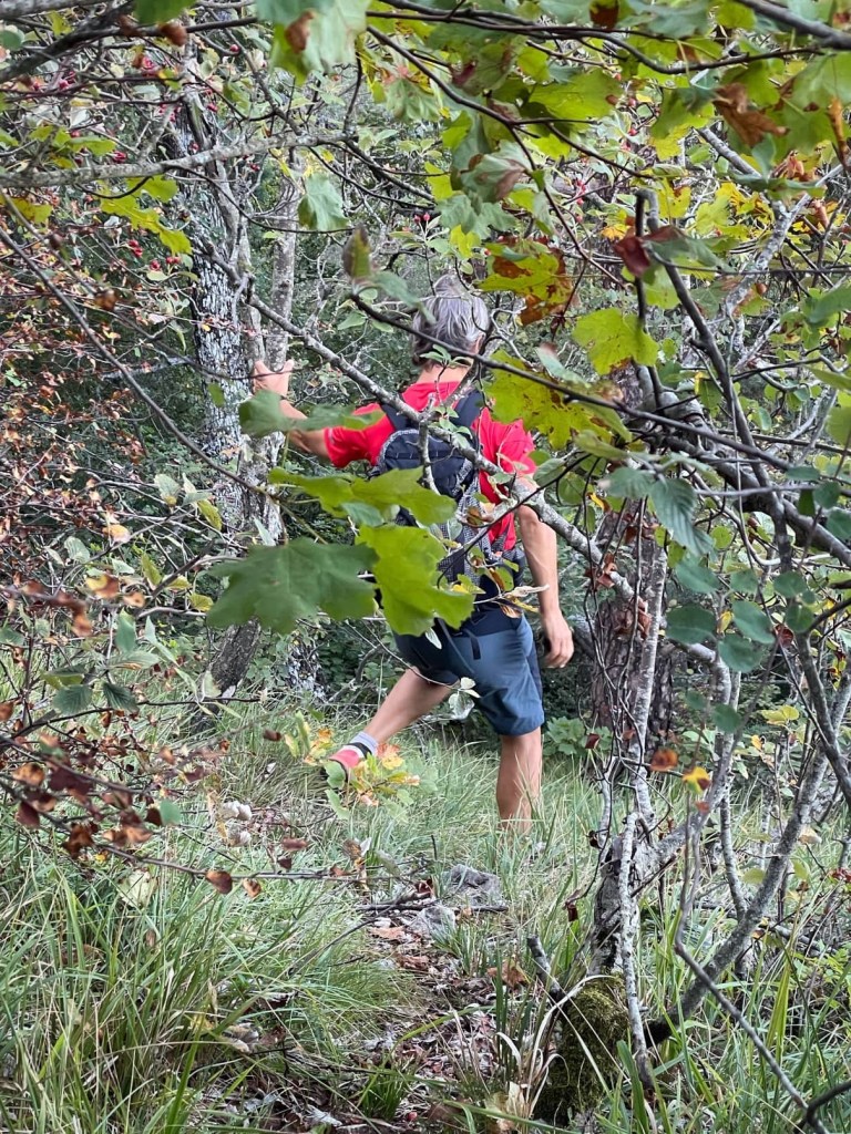
The forest reminded me of home because it was quite damp and had large oak and beech trees. When we got to it, the other side of the ridge was drier and scrubbier and felt more typically Provençal. As we started climbing more steeply at the end of the forest track, we took a path that petered out and we ended up bushwhacking our way back to the path we should have taken. Those who know me well won’t be surprised to hear I ended up in tears after slipping on my bum, and being whipped by branches, despite the fact I wasn’t hurt! I blame the adrenaline racing through my veins! 😳😆
We tried to find an area called Le Paradis which, apparently is very lush with green grass and a huge variety of flowering plants in the crevices in the rocks. However, we must have taken the wrong path somewhere and missed it (and the geocache that’s there) despite trying a couple of options. By now we were out of the shade and it was getting hotter so we decided to continue directly up to the ridge instead.
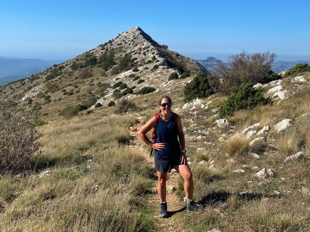
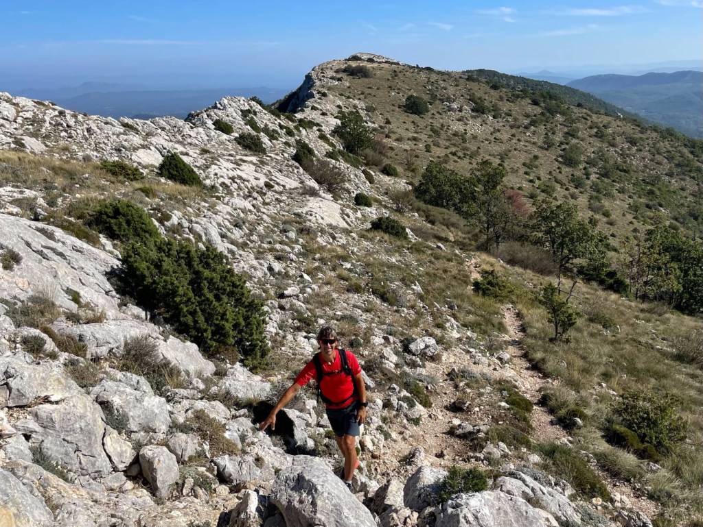
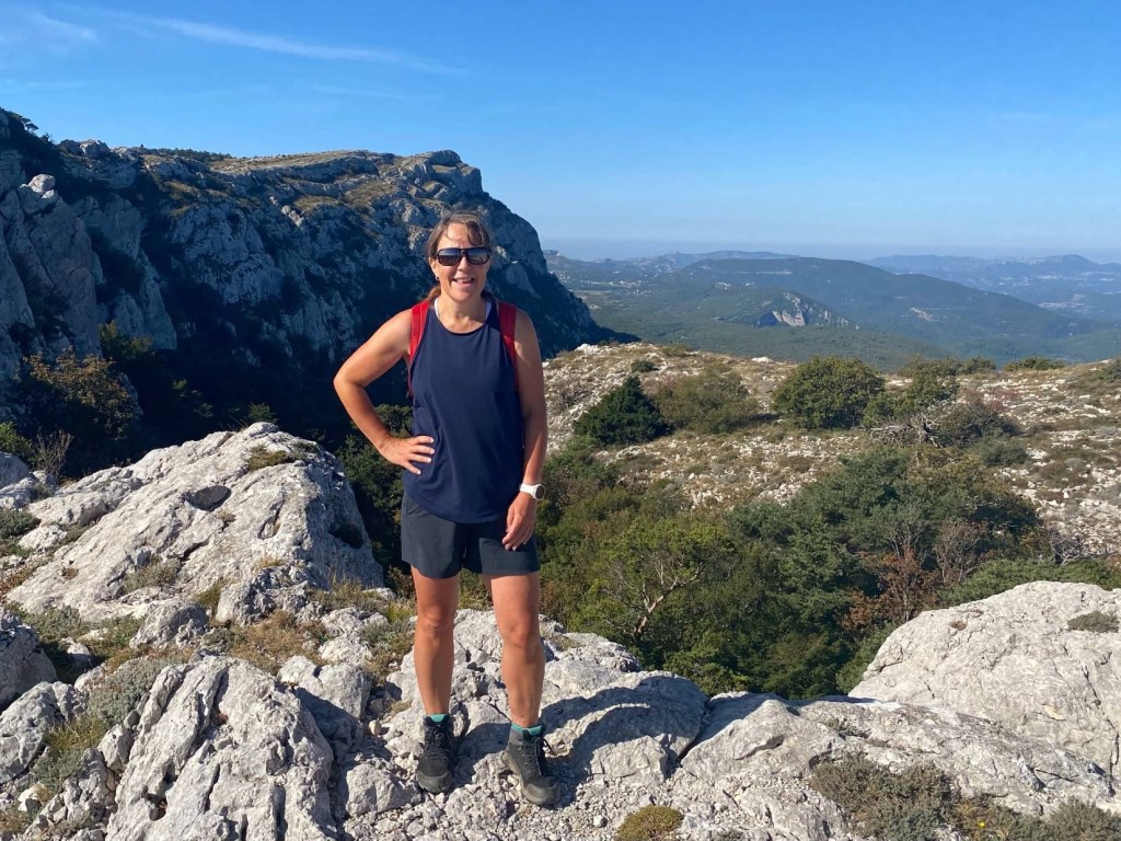
We followed the red and white stripes marking the GR9 national trail along the ridge for a couple of hours. The path was quite rough and rocky but the ascent was gradual and there was a lovely breeze to stop me overheating. After climbing over the first summit with a cairn on the top, we dropped a little before climbing again, more steeply, to the second. This one had a cross on the top.
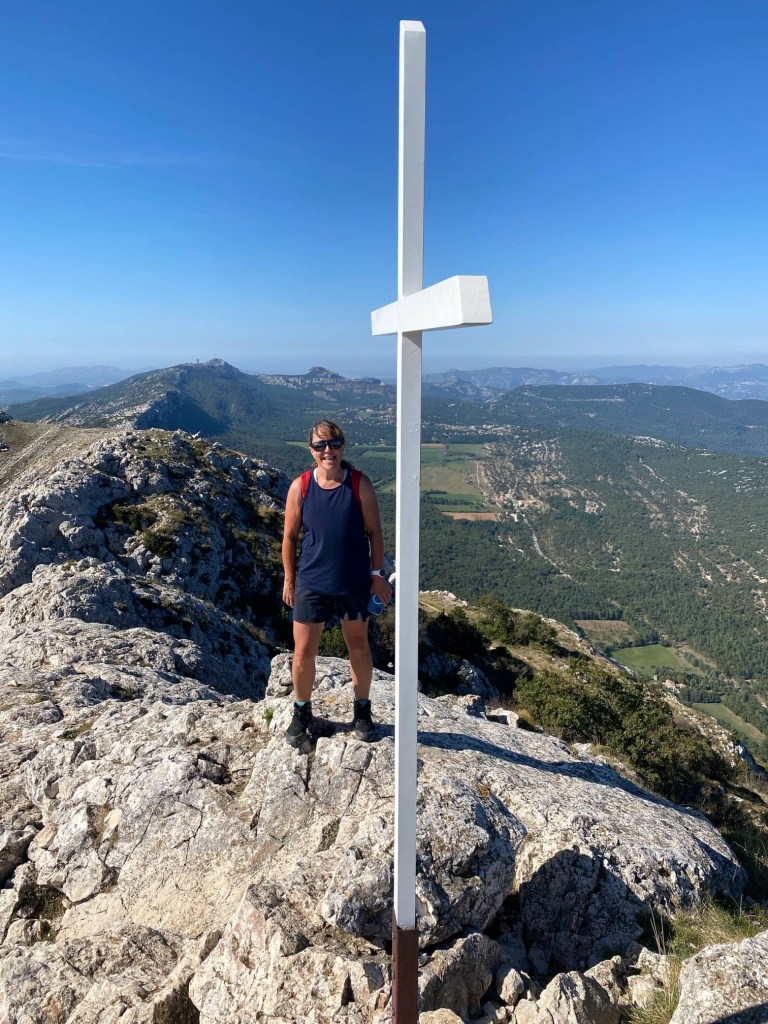

The views from the ridge are stunning in every direction. We could just about see the islands in the Mediterranean that we recently visited by boat, although they were very hazy. We hadn’t seen anyone up to now but, while we sat and had lunch on the top, a large group of about 20 French ramblers appeared from nowhere!


Finally, we came to the path we were taking down from the ridge. On our descent through the trees, we passed a cross, several shrines and a little chapel before we reached the turn off to Mary Magdalene’s grotto. It was a steep climb to this up a track and then 150 steps apparently representing the 150 Ave Marias of the rosary and 150 psalms of David.
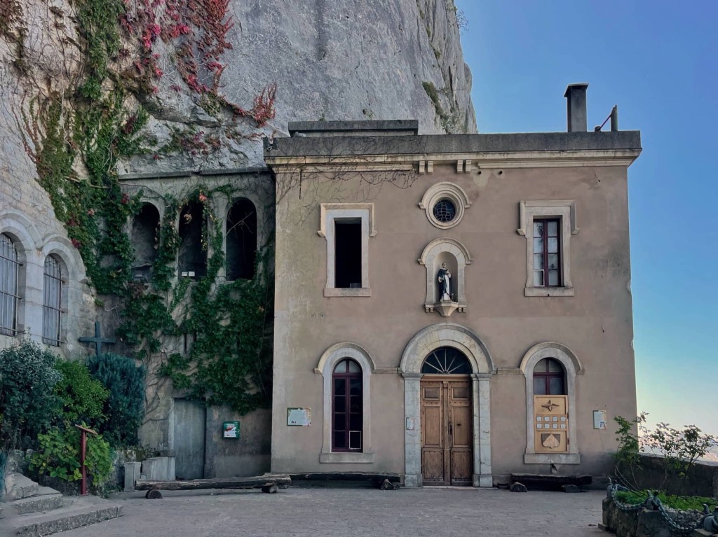
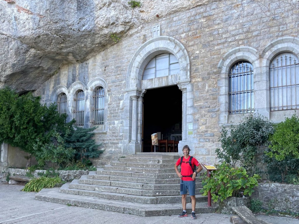
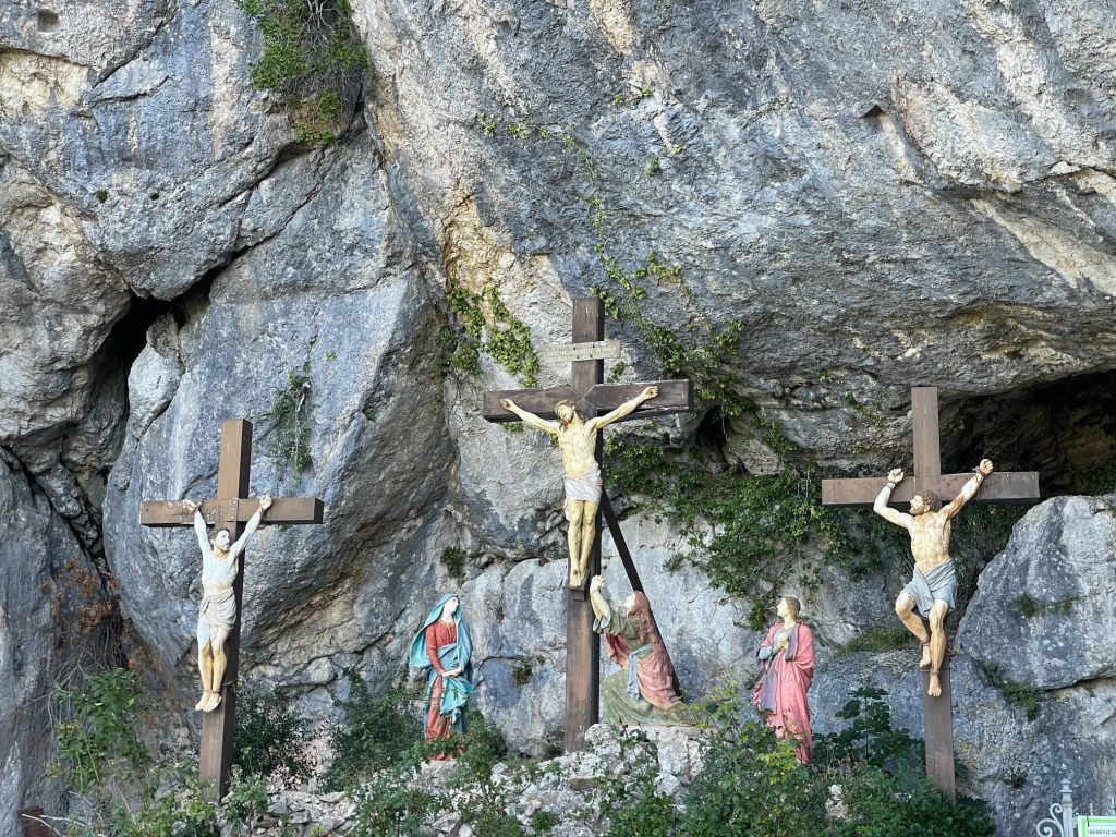
The grotto is hewn out of the rock and has an altar, statues and pews. Unfortunately the stained glass windows have been removed for renovation. There are also several other buildings outside, and statues of the crucifixion.

We retraced our steps from the grotto, then continued down the rocky path. There seemed no end to the steps through the trees, smooth and slippery from numerous feet over 100s of years. Despite the walk having been wonderful, we were glad to reach the bottom and see Bertie in the distance.

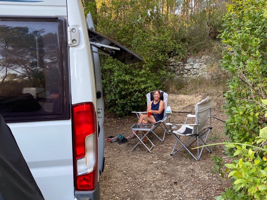
We’re now in a campsite just outside Aix-en-Provence. It was a nightmare finding a suitable pitch for Bertie. There weren’t many free and most were inaccessible or too small for us, despite our van not being particularly big. John’s had to reverse uphill and round tight corners, which the clutch didn’t like. Hot, tired and stressed, we then had a disagreement about how best to park on the pitch that was easiest for us to access. 🤬 It’s sloping, but we’ve managed to get a level position. 👍 Hopefully we’ll sleep well tonight. 😊🤞

An amazing hike there, what views!
LikeLiked by 1 person