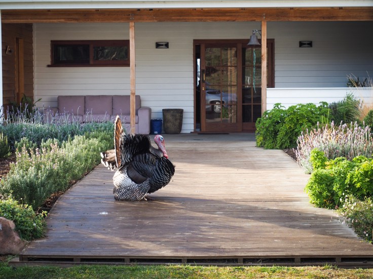
This morning, the plan was to visit Freycinet National Park to climb Mount Amos where we’d have a stunning view of Wineglass Bay. First, before checking out, we had another great breakfast with homemade bread and jam, prepared by our Airbnb host, Mike. He even got some bacon out of the freezer to make bacon butties especially for us! Today, we also got to meet Terry the Turkey who was showing off his plumage for us 🙂
It was a 2-hour drive to Freycinet National park and the first 45 minutes of the journey were on rough roads, reminding us of our travels in Iceland earlier in the year. The scenery is very different here from Iceland but just as beautiful. We passed through farmland and bush, which in the shaded valleys were very frosty. Once we emerged onto the main tarmaced road again, there was mist hanging in the valley… yet another photo opportunity!


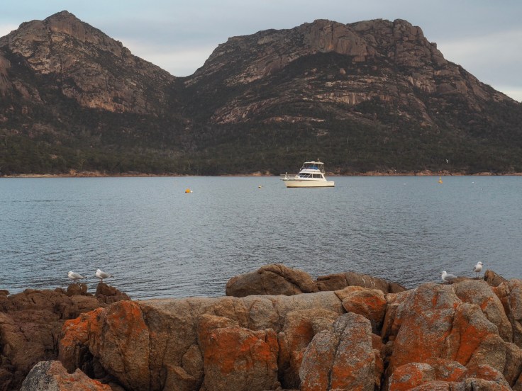
We had a few stops en route. The first was at Orford where we did some grocery shopping and checked out the beach with beautiful white sands. The next stop was Swansea where we had a coffee (and carrot cake!) and went to the bottle shop. 2 interesting points… Many of the towns are named after UK towns, and booze isn’t sold in supermarkets but in separate bottle shops. The final stop was at a look out tower at a vineyard where we could see the Freycinet Peninsula in the distance.


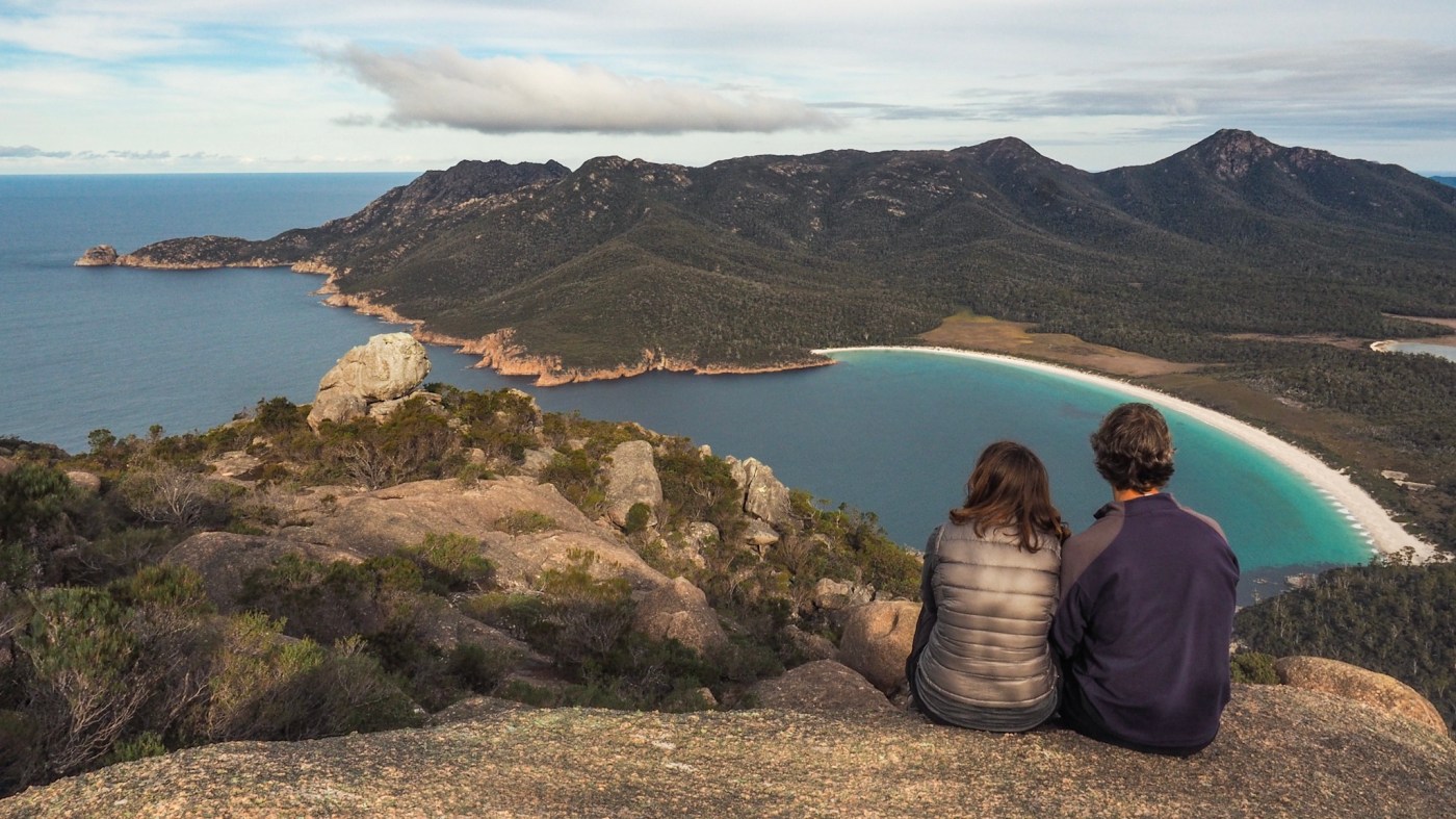
At about 1 o’clock we parked at the foot of the trails in Freycinet National Park and set off up Mount Amos. It’s a 3 to 5 hour trek and is over steep slippery rock so there are warning signs saying it shouldn’t be undertaken in wet weather or by people who are not properly equipped. It’s only 454 metres high but is quite difficult, involving scrambling most of the way. Most people go up an easier track to a look out point for Wineglass Bay but, of course, we had to do the harder option!


The path started off easily enough, undulating through the forest. After a while it became steeper, up flat rock. Most of the rock was quite grippy but we could see how it would be treacherous if it was wet, especially where the rock had previously been smoothed by running water. One section was particularly steep and I was quite scared of slipping and falling some distance. As we hauled ourselves up a difficult gully, I wondered if we should turn around. We had no idea how long it would be this steep for, or how far we had to go to the top. Luckily, at that point, a guy appeared on his way back down the mountain and said this was the hardest bit and we’d nearly completed it… it would be much easier now.


He was right. There was still some scrambling and we had to push through the bush in places, but there were no more scary sections. I pushed away the thoughts about what it’d be like on the way down and just kept going! We had been following yellow triangles marking the route all the way up and were amused and pleased to find one saying ‘Caution, summit approaching’!


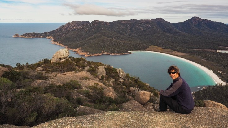
We stepped onto the summit about one and a half hours after leaving the car park. What a view! Wineglass Bay is just as beautiful as the guidebooks say and the view in the other direction was great too! We spent some time on the top taking photos, having something to eat and drink, and enjoying the view. There was nobody else around. We only saw 7 other people on this trail… 3 couples and the guy on his own. Amazing! We’ve rarely climbed peaks so quiet in the UK or any other country.
We finally decided we’d better go back down, setting off through the rocky landscape, and spotting another sign saying ‘Mt Amos? Completed it mate’! I’m pleased I didn’t give up. It was tough but very worth the effort and moments of panic.


There were a few more moments of panic on the way down. It wasn’t easy with little legs! I slipped on wet rock at one point and spent a lot of time sliding on my bottom on the steepest and trickiest sections, jamming my feet into gullys and gaps to stop myself sliding, and grabbing any available bush or tree to help me balance. John was very helpful too, pointing out good footholds and taking my hand when I needed help. There were some sections that were even scary for him with his long legs, but we soon passed through the worst bit and it gradually got easier after that.


The mountain was beautiful with it’s flat, stripy rock, much of it granite. It was very different from any we have climbed anywhere else because of the nature of the rock, the plants and even the wildlife. What a great experience!
We had something to eat in Coles Bay, from where we could look back at the Mount Amos, across the bay. By the time we finished eating it was dark. As we drove the half hour to our next Airbnb in Bicheno, John had to watch out for wallabies, Tasmanian devils and other marsupials that come out at night. We’ve seen a horrendous amount of roadkill. It’s very sad, particularly as some species are endangered. The signs do say the speed limit is lower at night but many people ignored this and overtook us.
We got to the Airbnb without incident and are now showered and in our pyjamas, catching up with various things we need to do… washing, emails, blogging. Then we’ll plan what to do tomorrow 🙂

That is an incredible view!
LikeLike